


Warning of further disruption due to snow and ice
Register for free to read more of the latest local news. It's easy and will only take a moment.

A further snow and ice yellow weather warning has been issued for the Grampian area.
The Met Office outlined that it will be in place from Friday morning until 9am on Saturday.
It stated that further snow showers are likely to lead to some travel delays and slippery surfaces.
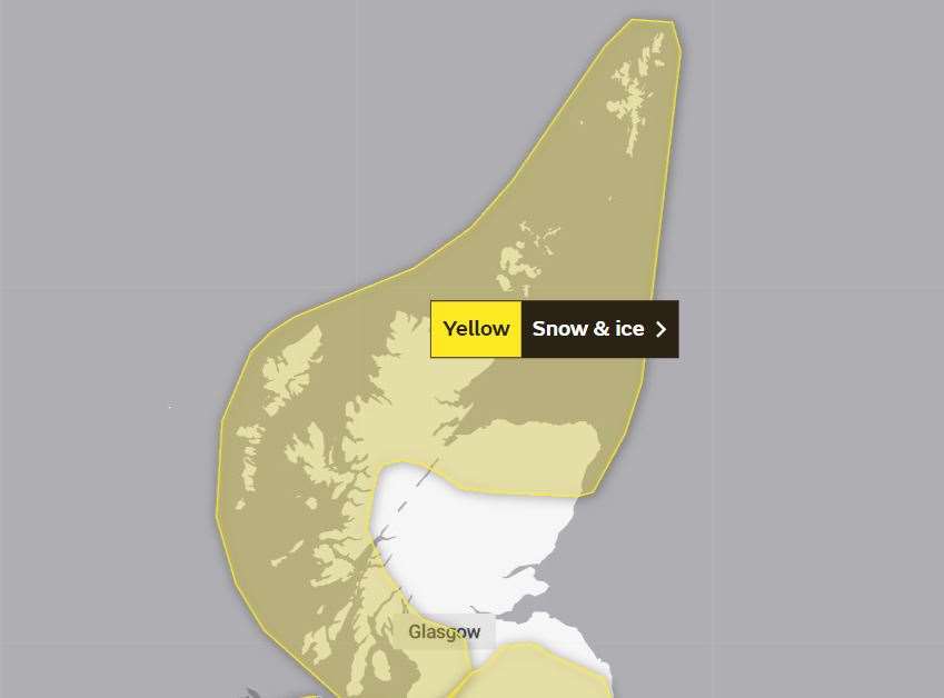
The weather warning added: "Snow showers will continue to affect the Northern Isles and the north of mainland Scotland through today, giving a few centimetres of lying snow in places.
"A more organised band of snow showers is expected to move south across northern Scotland this afternoon and evening, with showers becoming confined to northern and some western coastal areas overnight.
"Accumulations will be variable depending on where showers fall, but some places may see 2 to 5cm of snow.
"With a partial thaw of lying snow by day, there is an additional ice risk where this then freezes again overnight."
The Met office said the public should expect:
- Some roads and railways likely to be affected with longer journey times by road, bus and train services.
- Some injuries from slips and falls on icy surfaces.
- Probably some icy patches on some untreated roads, pavements and cycle paths.