


SEPA warns of coastal flooding this weekend as Met Office issues a yellow heavy rain warning for Tuesday
Register for free to read more of the latest local news. It's easy and will only take a moment.

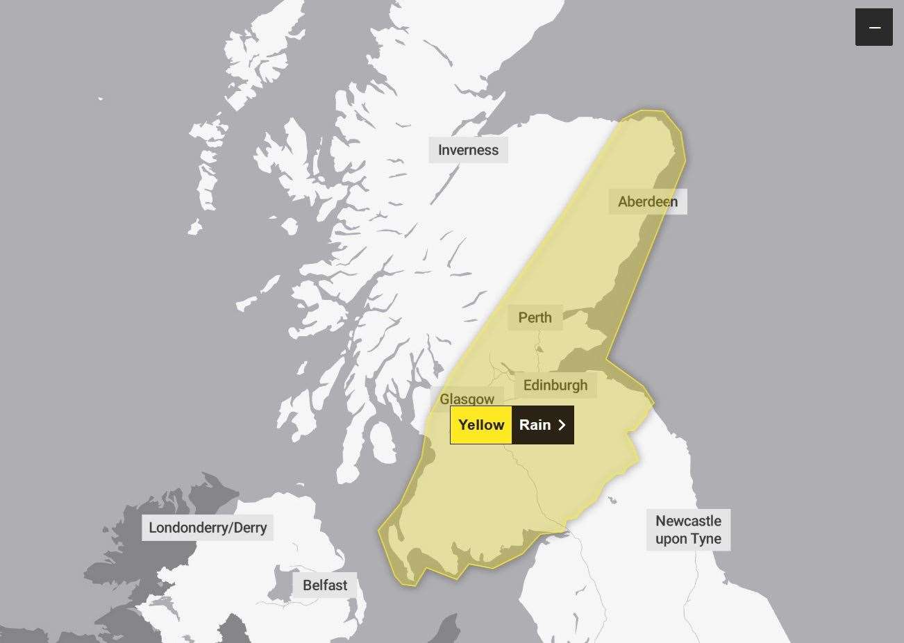
Rain will develop across parts of Scotland overnight Monday into Tuesday before clearing away into the North Sea on Tuesday afternoon or evening. There is a chance that this rain could be heavy and persistent, with some areas seeing 20-40 mm of rain, and a slight chance one or two spots could see 50-60 mm. Given the saturated ground in this region following recent heavy rainfall, the rainfall totals quoted above have the potential to cause greater impacts than would be typical.
SEPA has issued a warning of Sunday storm surges across coastal areas as it looks ahead to Tuesday impacts.
18 Regional Flood Alerts and 42 Local Flood Warnings remain
On Sunday and Monday significant flooding to coastal areas remains possible - in particular in the Western Isles and Orkney due to high tides, surge and waves.
On Tuesday, significant flooding from rivers and surface water is possible in southern, central and north-eastern areas, with coastal flooding continuing due to high sprint tides.
Warnings are in place for Nairn, Forres, Lossiemouthie, Cullen, Rothes, Peterhead, Fraserburgh, Ellon, Aberdeen, Inverurie, Kemnay, Ballater, Stonehaven and Marykirk.Janine Hensman, SEPA’s Flood Duty Manager, said: “Across Sunday, we’ll continue to see high tides, storm surge and large waves across coastal areas. This combination is particularly dangerous – especially around high tides.
“There is real danger to life from wave overtopping, particularly around causeways, coastal roads and paths. While the risk is greatest around high tide times, our message is clear : take extra care if you are near the coast at any point and stay well clear of waves and water. Be careful when travelling around exposed coastal areas and don’t walk or drive through flood water as there may be hidden hazards.
“Whilst Storm Kathleen will ease on Sunday evening, another weather system is on the way. Significant flooding from rivers and surface water is possible in southern, central and north-eastern areas on Tuesday, with coastal flooding continuing due to high spring tides.
“Flood Alerts and Warnings are in place so stay up to date though our website. We will continue to work with the Met Office to monitor the situation 24/7 and review regional Flood Alerts and local Flood Warnings as required.”