


Wintry showers and sub-zero temperatures set to continue across UK
Register for free to read more of the latest local news. It's easy and will only take a moment.
Parts of the UK could see 5cm of snow on Friday with temperatures expected to drop as low as minus 10C in some areas.
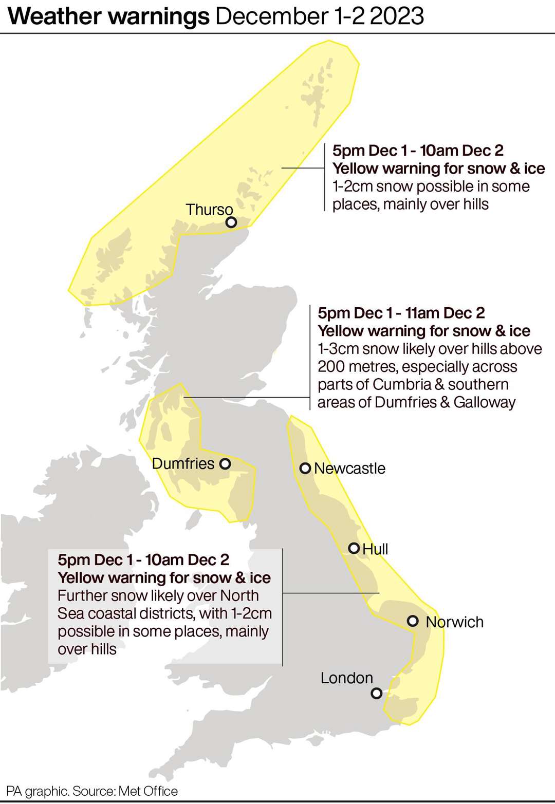
A yellow weather warning for snow and ice will remain in place on Friday for the eastern coast of the the UK, stretching from Scotland to East Anglia. Ice warnings remain in place for Northern Ireland and south-west England.
Hilly areas including the North York Moors and parts of Scotland will see more snow on Friday, forecasters said.
Snow swept across the South West, parts of Yorkshire, the North East and Scotland on Thursday.
More than 30 schools in Cornwall closed for the day or opened late due to hazardous conditions.
In County Durham, police said snowy conditions led to some crashes on the roads.
Another widespread frost is expected on Friday morning, with overnight temperatures dropping as low as minus 6C in south-west England, minus 8C in Wales and minus 10C in parts of Scotland, the Met Office said.
Met Office meteorologist Ellie Glaisyer said: “For most of us it will be dry and bright. There will be some wintry showers over the hills.
“There could be 2cm to 5cm of snow for areas 100m to 200m above sea level, with rain falling at lower levels, particularly Northern Ireland and western Scotland.
“The North York Moors and parts of Scotland will likely get snow.
“There will be another widespread frost, with a max temperature of 5C across the South.”
The UK Health Security Agency and the Met Office have issued amber cold health alerts in five regions: the East Midlands, West Midlands, North West, North East and Yorkshire and the Humber; until December 5, meaning “cold weather impacts are likely to be felt across the whole health service for an extended period of time”.
For those who may be travelling on the roads this weekend, National Network Manager at National Highways, Dale Hipkiss, advised motorists to keep an winter kit in the car while driving.
“Keeping a kit of essential items like a torch and warm clothes, in your vehicle, can be vital in case you and your passengers become stranded,” he said.
“Freezing conditions bring so many hazards such as snow and ice, so please … plan ahead for your journey, check weather forecasts, and if weather conditions do become challenging whilst travelling, adjust your driving behaviour and take extra care.
“It’s also a good idea for people to check (your) vehicles, such as tyres, coolant and oil levels, etc. before heading out to reduce the risk of breakdowns.”
He added: “If you do unfortunately find yourself in an unsafe or vulnerable situation and need assistance, please contact the emergency services.”
Moving into next week, the weather is likely to remain cold with a north-easterly air flow pushing through frigid air from the north.
The Met Office predicts a good deal of dry, sunny weather for many, showers remain possible across the UK, particularly in eastern coastal areas.
However, showers could turn wintry at times.
The weather will become increasingly unsettled and less cold in southern and central areas next week, but it will probably remain cold with further coastal wintry showers in the north.