


Hot weekend coming but thunderstorm threat looms, Met Office says
Register for free to read more of the latest local news. It's easy and will only take a moment.
Warm weather this weekend as the record heatwave continues could be spoiled by thunderstorms in some areas, the Met Office has said.
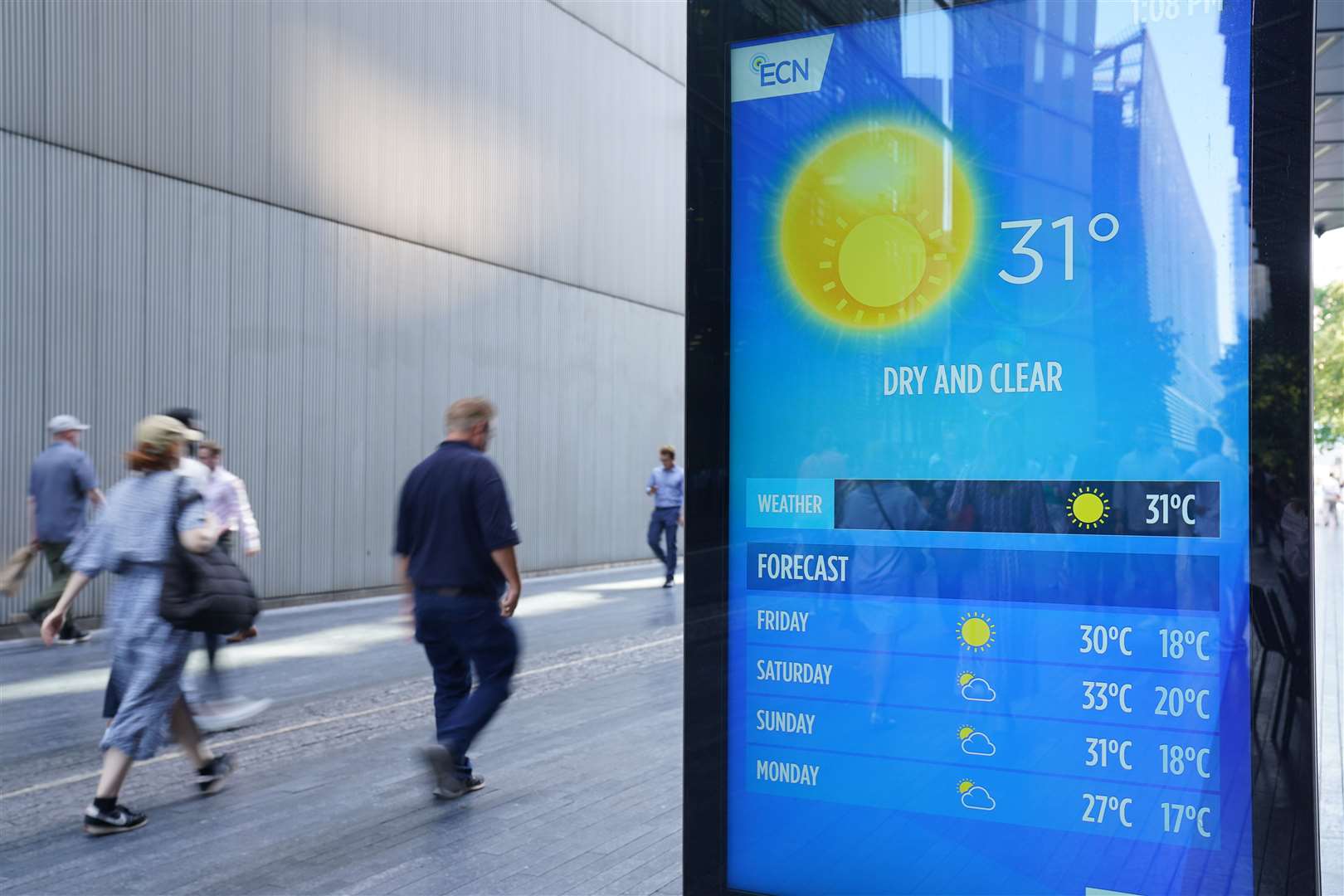
Friday is likely to be the fifth day in a row when temperatures top 30C, according to the forecaster, but there is an increasing chance of some intense thundery downpours developing in central and western areas.
Thursday was provisionally the hottest day of the year so far, with 32.6C recorded in Wisley, Surrey.
That temperature could be exceeded towards the end of the week, forecasters believe.
The warm weather will continue into the weekend – especially in the south-east – but sporadic thunderstorms could spoil the party by bringing heavy showers and even hail for some, the Met Office said.
Spokesman Stephen Dixon said a secondary temperature peak could happen on Saturday.
He said: “For most people it will still be a dry and fine Saturday and temperatures will remain high.
“The south and east of the country will probably hold on to the hot weather the longest.
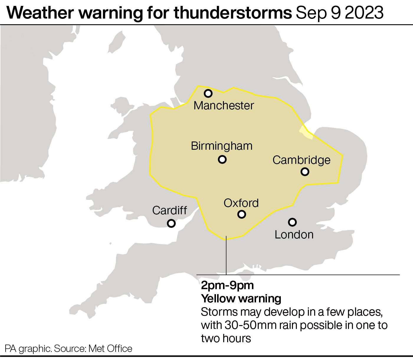
“But we have issued a yellow weather warning for thunderstorms on Saturday afternoon for central England and eastern Wales.
“Some might see 30-50mm of rain; there’s a possibility of hail and lightning.
“Not everyone will see these showers; they’ll pop up here and there.
“There’s a bit of a weather breakdown on the way. Some might see thundery rain but it will stay hot.
“On Sunday the hot weather will be more confined to the south and east.
“Elsewhere, it will become more unsettled and temperatures will return to the high teens.
“There is a continued chance of further warnings as we monitor the weather.”