


Met Office: Storm Babet will bring heavy rain across parts of the north-east
Register for free to read more of the latest local news. It's easy and will only take a moment.

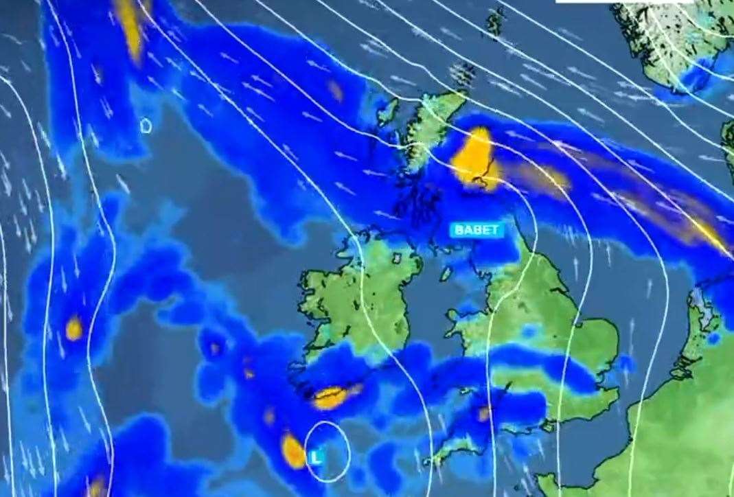
Heavy rain will move into the west of the UK on Tuesday evening as Storm Babet brings increasingly wet and windy weather. The rain will spread more widely across the UK on Wednesday bringing heavy downpours to most parts through the day.
As the rain moves northwards it will stall across central and eastern parts of Scotland where the rain will become heavy and persistent from Thursday through to Saturday.
There is a Severe Weather Warning for rain for this area where up to 150-200 mm of rain could accumulate in some areas of higher ground.
A prolonged period of strong southeasterly winds, peaking through Thursday and early Friday, and coupled with heavy and persistent rain across eastern Scotland in particular, brings the potention for disruption, especially to travel. Gusts of wind of 40-50 mph can be expected quite widely within the warning area, but coastal eastern Scotland, Orkney and more locally to the lee of the mountains in the west, could locally experience gusts as high as 60-70 mph. Large waves could be an additional hazard around North Sea coasts.
Whilst there is still some uncertainty in the timing and duration of rain through this coming week, there is potential for disruptive, heavy and prolonged rainfall to affect central and eastern Scotland.
The heaviest rainfall is more likely to occur over Angus and southeast Grampian, although even lower lying areas could see unusually heavy rainfall during this period. Widely 70-100 mm of rain is likely to fall, but some upland areas may see as much as 150-200 mm of rain through this period.
Deputy Chief Meteorologist, Steven Keates said: “Storm Babet will bring impactful rain to many parts of the UK, but especially parts of eastern Scotland, Northern Ireland and northern England later this week.
"Heavy and persistent rain will fall onto already saturated ground bringing a risk of flooding. It is important to stay up to date with warnings from your local flood warning agency as well as the local authorities.
“As well as heavy rain, Storm Babet will bring some very strong winds and large waves near some eastern coasts too. Gusts in excess of 60mph are possible in eastern and northern Scotland from Thursday. It is likely Met Office warnings will be updated through the week.”
David Morgan, Flood Duty Manager for the Scottish Environment Protection Agency (SEPA), said: “Storm Babet will bring heavy rain and high winds across Scotland from Wednesday evening, starting in the South West before moving across to the north-east through Thursday and into the weekend.
“Impacts from surface water and rivers are likely, and with catchments saturated from recent heavy rain and flooding, we’re urging people to be prepared for potential flooding. There is also concern that surface water flooding may be exacerbated by debris blocking drainage, culverts, etc. as a result of the high winds.
“Flood Alerts and Warnings will be issued as required, and we continue to work with the Met Office to monitor the situation 24/7. People can check our Flood Updates for all the latest information and the three-day Scottish Flood Forecast to see what conditions are expected further ahead.
“If you live or work in an area that could be affected, consider any steps you need to take now to be prepared and stay safe, and to take extra care if you need to travel.
“If you have not already signed up to Floodline, you can do so now to receive free updates for where you live, or travel through, directly to your phone. "