


Scottish Government now publishing more detailed coronavirus data
Register for free to read more of the latest local news. It's easy and will only take a moment.

SINCE the start of the coronavirus pandemic, many people have been asking the same question: whereabouts in Moray are the new covid-19 cases located?
This data has not previously been available – but that has now changed with the Scottish Government beginning to publish coronavirus data by neighbourhood area.
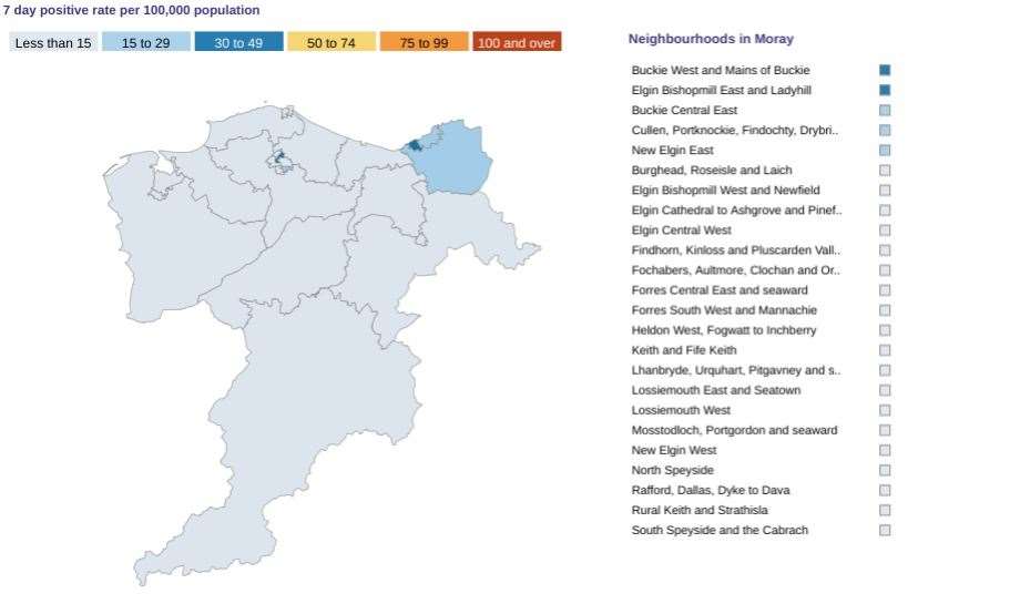
Moray has been split into 24 different areas, with the seven-day positive rate per 100,000 of population shown for each.
Data from the start of the outbreak to the present day can be searched for using a new tool on the Scottish Government's website. However, disclosure is applied when the number of cases in a local authority is fewer than five – making a neighbourhood breakdown unavailable to protect patient confidentiality.
The most recent data shows that most of the cases recently confirmed in Moray centre around the Buckie East, Buckie West and Mains of Buckie districts, with the Bishopmill and Ladyhill areas of Elgin also affected.
You can view the data by clicking HERE .